The Rembo Bongo
At the south end near Gamba and all the way to the eastern side, the lagoon is bordered by dense forest and only a couple villages, so as soon as you leave Gamba you are suddenly in a remote wilderness. On the eastern part of the lagoon, big green rolling hills rise up behind the forest and off in the distance are the mountains of Moukalaba–Doudou National Park. Moukalaba–Doudou is one of the parks that is still mostly completely wild- only a few logging concessions, no tourist infrastructure and a whole lot of elephants! Bas tells me that in this N’dogo area of Gabon there are 7,000 people and approximately 11,000 elephants. The Rembo Bongo forms the western border of the park.
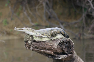 Faux Gavial (Crocodylus cataphractus)
The water levels are still low from the dry season, so the first two lakes looked almost like fields; tall grasses with narrow channels of water. The first of the larger lakes, Lac Gore, had a deep channel leading from the main river with a high mud embankment. The water will rise at least 10 feet in this upper part of the river in the height of the wet season. The water will overflow the banks and flood the forest, which then allows manatees to feed there, as well as on all the grasses on the lake beds that become submerged.
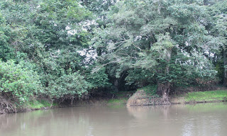 Entrance to Lac Gore (pronounced Gor-A, I don’t have a French keyboard to put the accent over the “e”)
On Friday morning we continued north to Lac Mafoume, the second large lake. This one also has an entrance channel about 1 mile long leading in from the main river. Along this stretch Victor, the local manatee hunter, has his fishing camp, so we stopped in to talk to him. He was very friendly and was wearing a shirt that said Florida on it! Of course he has absolutely no idea where Florida is. Anyway, he had a lot of good information about manatee use of the lake, group sizes (he’s seen up to 10 individuals together), etc. He now only kills 1 per year, for the village festival in October. He sees them in all the lakes and also confirmed their seasonality. After talking with him and his family, we went up to the lake, which was about 2 miles long, placid and bordered by grasses everywhere. We saw 7 forest buffalo bathing in the lake.
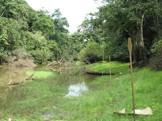 Lake channel in front of the manatee hunter’s camp. You can see there are alot of fallen trees that the boat must be maneuvered around.
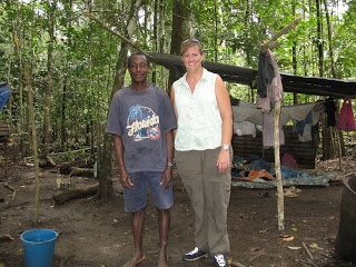 With Victor at his camp
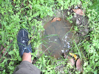 Elephant footprint
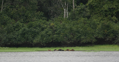 Bathing buffalo. We could’ve gone closer, but I didn’t want to spook them.
The final lake was inaccessable because of fallen logs in the river, but I have a picture of the area now. When I asked people where the manatees go when they aren’t in the river, everyone said “to Sette Cama” (town in the northern end of the lagoon). Luckily, that’s where I’m headed next!
