Staff Links

Following the Manatee Trail

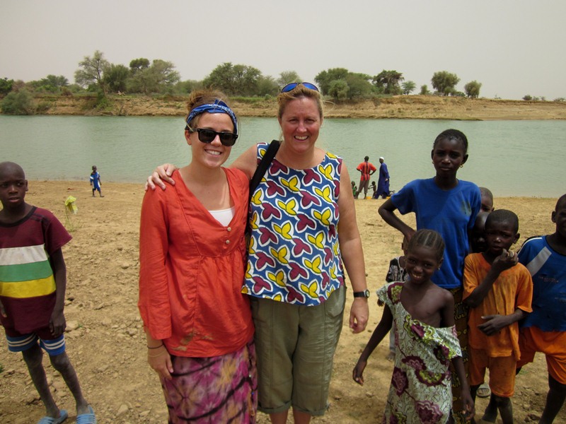
Back in 2009 I tagged three manatees in the Senegal River as part of a collaborative study with my colleagues from CBD- Habitat (a Spanish NGO) and Oceanium Dakar (a Senegalese NGO). You can see my original post about it here. It was the first time West African manatees had ever been tagged with satellite-linked tags, and we learned alot about their dry season movements in the eastern Senegal River, work which I plan to continue (more on that later). However, because the 2009 tagging was an opportunity that arose unexpectedly as a result of manatees becoming trapped behind an agricultural dam and needing to be rescued, we didn’t have a budget for tracking them in the field once they were released. You can learn some great things from satellite data, but what you don’t get is information about manatee behavior. We know where they went, but there were no field observations to determine what they did at each place, how many other manatees they might have been with, etc. At the time we knew that getting some basic first information about the manatees’ habitat use was better than nothing (after all, no one had ever satellite tagged them before), and we assumed that after being trapped for months with almost no food they would probably go to feeding locations, but ever since I’ve been curious to check out some of the places they chose to go while tagged. Last week I finally got the chance.

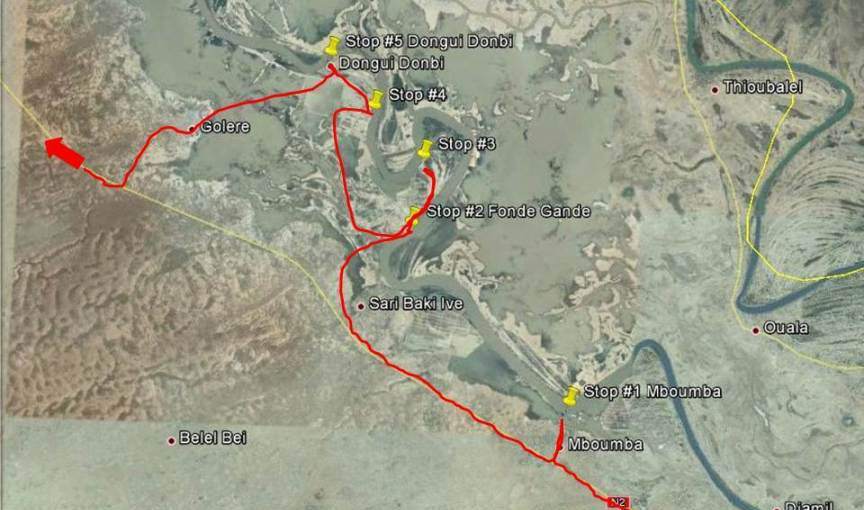
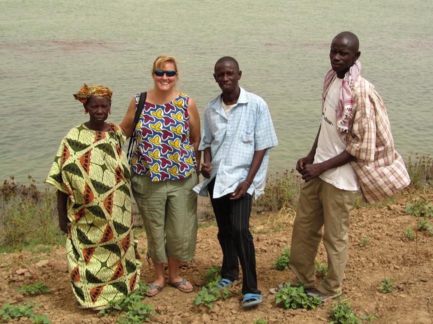
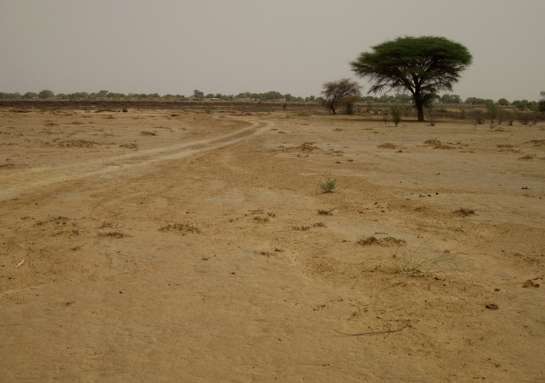
After finishing up the necropsies and a very productive meeting with the local Water and Forestry Dept., we left Matam very early in the morning last Tuesday and headed north back up the road that eventually leads to Dakar. After about 2 hours we left the main road and headed off east on a sand track. We brought a guide with us who knew the area where we were headed because he grew up in one of the villages, otherwise it would’ve been unwise to drive off the only real road into such an immense and remote desert. There are no signs and many tracks through the brush, so you really need to know where you’re going. Acacia bushes are everywhere and have huge spines that can easily puncture tires. So few outsiders ever venture to this area that people run in terror from the sight of a car (it literally might as well be a space ship), and teenage girls are afraid because they’ve never seen a white person before.

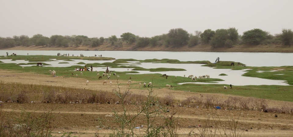
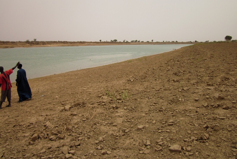
I was armed with maps of our two male manatee tag locations from this area, and was hoping to be able to drive along the Senegal River. I quickly realized that this wasn’t going to be possible. The Senegal River floods an insanely huge area every rainy season (over 30 miles wide in some places) but shrinks down to a tiny river barely a half mile wide during the dry season. So roads and villages that sit on the edge of the floodplain are miles away from the river during the dry season. And even when you reach the river’s edge, it’s prime land for farms, so no tracks run directly along it. Instead we went to villages and other points along the river where we were able to see places where our red tagged manatee had been.  

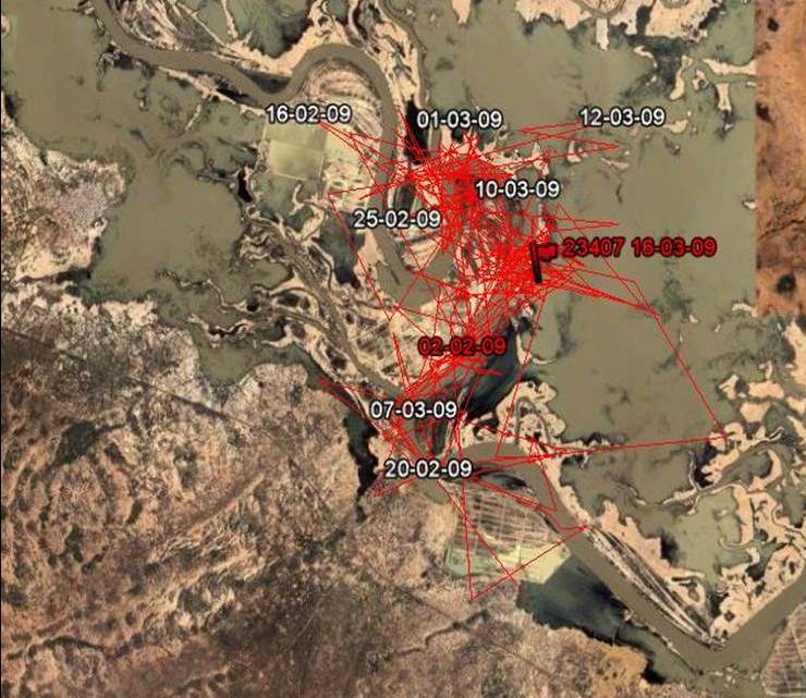
Here’s a map of one month worth of manatee locations from 2009. This manatee moved directly to this small area (only a couple miles wide) as soon as he was released, and stayed here for 4 months. The thin strip of grey in the center is the river during the dry season, the larger grey areas around it are flood zones (Map courtesy of CBD-Habitat).

Below is the same stretch of river from the map above (zoomed out a bit), and the red line and yellow point markers are our trip in order to see the parts of the river (basically two large oxbows) where the manatee spent 4 months. 
Our first stop was a larger town called Mboumba. We drove down to the river’s edge and asked some locals about manatees. They told us they see them passing through, but they never stay for long. They did point out one marshy area across the river where manatees have been seen feeding.

Next we headed to the first oxbow of the river and stopped at Fonde Gande, our guide’s village. There were huge fields and an agricultural dam which I was happy to find grated against the entry of curious manatees, but what really surprised me was the huge amount of aquatic plants we could see, just from the shoreline. The other interesting thing was that the water was blue and relatively clear, not muddy as in other parts of the river. It was definitely an “Aha!” moment, a happy verification that there WAS something different about this place that would draw and keep manatees here. In the photo below the dark blobs in the water are bunches of a (yet to be identified) aquatic plant, and you can see a raft of leaves of 2 plant species along the shoreline. I collected samples for stable isotope analysis. 


This is the pastoral scene in front of Fonde Gande… all that grass is underwater when the manatees are here in winter.
Our guide Haradi (on right) introduced us to his mother and brother, as well as other villagers who told us there are groups of manatees here for 3-4 months annually, just after the rainy season. They described mating behavior (groups of manatees rolling at the surface, tails flapping out of the water) as well as seeing them feeding. No one here hunts them here.

The last village we visited was Dongui Donbi (which actually sounds like “Doggie Donbi” in the local pronounciation). In the rainy season this village becomes an island within the huge flood plain of the river. The chief greeted us and told us they had seen a manatee feeding there about 4 days ago, then led us out to the river to have a look. Unfortunately we didn’t see any, but with the wealth of aquatic plants here I’m not surprised if there are some around.
 While we were standing there I got a huge surprise… an American Peace Corps volunteer came walking up! The villagers had gone to get her because they assumed I was either her boss or her mother (that made me feel old!), because why else would another white person come there?! It turns out Irin is an agricultural volunteer and has been there 7 months. She had no idea there were manatees in the river but all the kids laughed and said of course they knew about the manatees! Irin told me she’d be happy to record the villagers sightings and send them to me, so I hope she will!  
East of this part of the river there’s another branch of the Senegal River, and that’s where a second of our tagged manatees had spent considerable time in 2009. Although I’d hoped to get there as well, it turned out to be very complicated (there was only one bridge and it was difficult to get to, and our car was still having issues so we were afraid of getting stranded too far out in the desert), so we’ll have to save that trip for next time.
No Comments

Post a Comment

Donate

Please do not display my name publicly. I would like to remain anonymous.

Please add me to your mailing list.

I would like to make a donation in the amount of:

$100$50Other
I would like this donation to go to a specific fund

I would like this donation to repeat each month

African Aquatic Conservation Fund is registered in the United States as a 501(c)(3) organization. All donations are tax-deductible.

Contact Us


    Your Name

    Your Email

    Subject

    Your Message

    [recaptcha class:main-contact-captcha]

    Address

    P.O. Box 366
    Chilmark, MA 02535

    BP 80 Joal
    23015, Senegal, West Africa

    Email

    info@africanaquaticconservation.org

    Phone

    United States: +1 508-388-9824